Raleigh, NC Wall Map and 50 similar items
Free Shipping
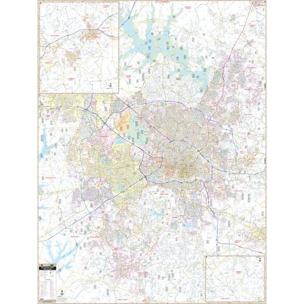
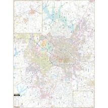
Raleigh, NC Wall Map
$234.63
Sign up and get $15.00 bCredits free to use at checkout and another $5.00 bCredits when you make your first purchase. More info
Share & earn! Sign in, share this or any listing, and you’ll get commission when it sells.
Learn more
View full item details »

Shipping options
Estimated to arrive by Wed, Nov 5th.
Details
FREE via UPS Ground (1 to 5 business days) to United States
Return policy
Replacement product available within 30 days
Details
Purchase protection
Payment options
PayPal accepted
PayPal Credit accepted
Venmo accepted
PayPal, MasterCard, Visa, Discover, and American Express accepted
Maestro accepted
Amazon Pay accepted
Nuvei accepted
View full item details »
Shipping options
Estimated to arrive by Wed, Nov 5th.
Details
FREE via UPS Ground (1 to 5 business days) to United States
Return policy
Replacement product available within 30 days
Details
Purchase protection
Payment options
PayPal accepted
PayPal Credit accepted
Venmo accepted
PayPal, MasterCard, Visa, Discover, and American Express accepted
Maestro accepted
Amazon Pay accepted
Nuvei accepted
Item traits
| Category: | |
|---|---|
| Quantity Available: |
Only one in stock, order soon |
| Condition: |
New |
| Country/Region of Manufacture: |
United States |
Listing details
| Seller policies: | |
|---|---|
| Posted for sale: |
More than a week ago |
| Item number: |
638625717 |
Item description
The Raleigh and Wake County, North Carolina Wall Map measures 59? x 78?. This commercial wall map shows all of Wake County in complete street detail. Boundaries range: North: to the Durham County Line including the Research Triangle Park; South: to the Harnett County Line; East: to the Johnston County Line; West: to the Chatham County Line. The map also shows a proposed Wake Expressway. Special features, data, and details include all streets and highways, government buildings, airports, golf courses and country clubs, railroads, longitude and latitude lines, block numbers, shopping centers, recreation parks, mileage circles, cemeteries, educational facilities, hospitals, post offices, city limits and annexations, block numbers, longitude and latitude lines, water features, fire and police stations, fire district lines, ZIP codes and boundaries, and assorted points of interest. Width 58, Height 77 . 58? x 77?
|
Why are we showing these items?
Search Results
Map, transportation"map" Category "Transportation"
|


 - $2.95")
 - $3.75")

 - $3.70")


-
Refine your browsing experience
We can show you more items that are exactly like the original item, or we can show you items that are similar in spirit. By default we show you a mix.


This item has been added to your cart
 Raleigh, NC Wall Map added to cart.
 Please wait while we finish adding this item to your cart.
Get an item reminder
We'll email you a link to your item now and follow up with a single reminder (if you'd like one). That's it! No spam, no hassle.
Already have an account?
Log in and add this item to your wish list.