HISTORIX Vintage 1883 Aberdeen South Dakota and 50 similar items


Free Shipping
HISTORIX Vintage 1883 Aberdeen South Dakota Map Print - 16x24 Inch Old Bird's Ey
$39.99 - $59.99
View full item details »

Shipping options
Seller handling time is 1 business day Details
FREE via to United States
Return policy
Full refund available for DOAs
Details
Purchase protection
Payment options
PayPal accepted
PayPal Credit accepted
Venmo accepted
PayPal, MasterCard, Visa, Discover, and American Express accepted
Maestro accepted
Amazon Pay accepted
Nuvei accepted
View full item details »
Shipping options
Seller handling time is 1 business day Details
FREE via to United States
Return policy
Full refund available for DOAs
Details
Purchase protection
Payment options
PayPal accepted
PayPal Credit accepted
Venmo accepted
PayPal, MasterCard, Visa, Discover, and American Express accepted
Maestro accepted
Amazon Pay accepted
Nuvei accepted
Item traits
| Category: | |
|---|---|
| Quantity Available: |
16 in stock |
| Condition: |
New |
| ASIN: |
B0C2K396HF |
| Item Name: | |
| Item Type Keyword: |
prints |
| Brand: |
HISTORIX |
| sizes: |
Listing details
| Seller policies: | |
|---|---|
| Shipping discount: |
Seller pays shipping for this item. |
| Posted for sale: |
May 1 |
| Item number: |
1743618621 |
Item description
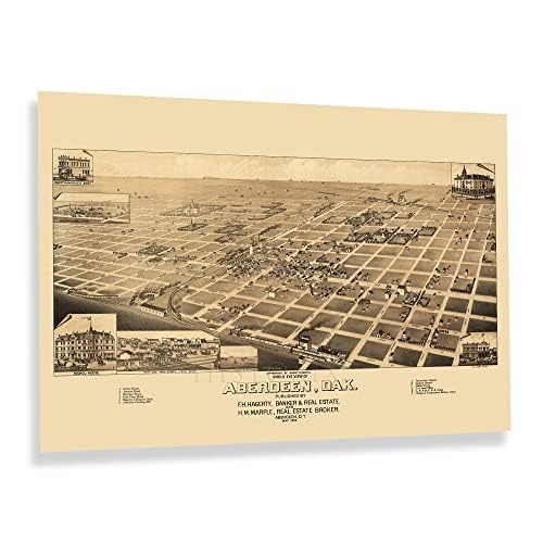
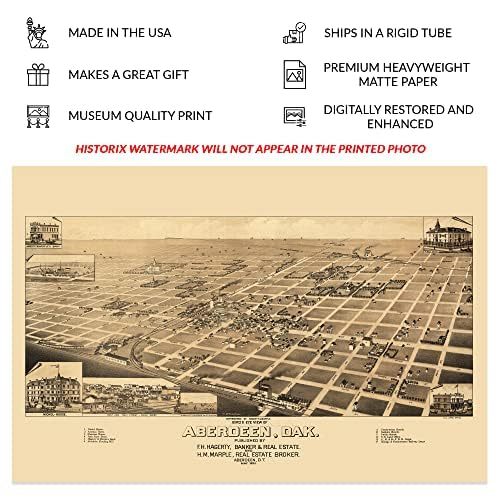
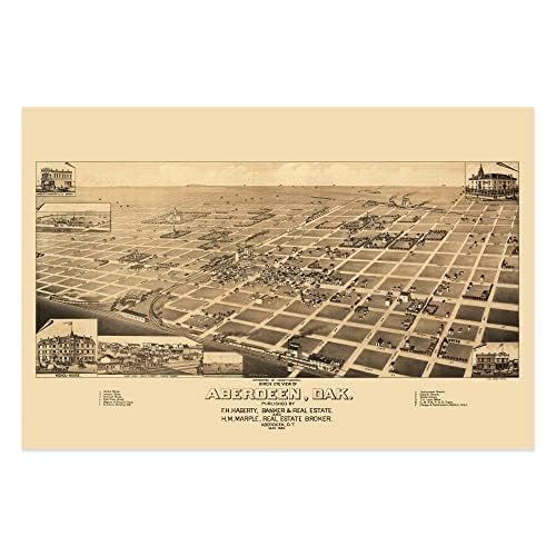
As the expansion of rail lines continued during the latter portion of the twentieth century, towns and cities like Aberdeen, South Dakota, were established across the North and West of America. The opportunity to buy land and create communities became more accessible for immigrants from across Eastern and Western Europe who built neighborhoods based on cultural traditions and a shared heritage which remain to this day. Aberdeen was incorporated in 1882, less than a decade prior to this panoramic map's publication. Aberdeen became a vital railway hub earning it the nickname "Hub City of the Dakotas."
As the nation neared the turn of the century, the region was experiencing significant growth and transformation as economic opportunities in mining and logging attracted residents eager to work in these thriving industries. Panoramic maps served as marketing materials to promote towns and cities across the nation and highlighted economic opportunities, notable civic buildings, and natural attractions to entice residents and merchants alike. Bird's eye perspectives were widely popular during the latter portion of the eighteenth and early twentieth century and bear a distinctive aesthetic and unique style that immediately transports the viewer back in time, creating an indelible link to the past and a glimpse of an area's distinct history.
This map was produced and published by Henry Wellge, one of the most prolific cartographers of the era, who was responsible for over half of all panoramic maps in the Library of Congress with four other mapmakers. This illustration is an authentic piece of American cartographical history.
|
Why are we showing these items?
Booth
Historic Prints |

|


-
Refine your browsing experience
We can show you more items that are exactly like the original item, or we can show you items that are similar in spirit. By default we show you a mix.


This item has been added to your cart
 HISTORIX Vintage 1883 Aberdeen South Dakota Map Print - 16x24 Inch Old Bird's Ey added to cart.
16 available in stock
HISTORIX Vintage 1883 Aberdeen South Dakota Map Print - 16x24 Inch Old Bird's Ey added to cart.
16 available in stock
View Cart or continue shopping.
 Please wait while we finish adding this item to your cart.
Get an item reminder
We'll email you a link to your item now and follow up with a single reminder (if you'd like one). That's it! No spam, no hassle.
Already have an account?
Log in and add this item to your wish list.