18th Century Dutch Map – Kersmis Kanaal, and 49 similar items
18th Century Dutch Map – Kersmis Kanaal, Tierra del Fuego – Cook’s Second Voyage
$89.00
(It may be possible to pay only $86.00 instead of $89.00 when you
use your bCredits at checkout)
Sign up and get $5.00 bCredits free to use at checkout and another $5.00 bCredits when you make your first purchase. More info
Share & earn! Sign in, share this or any listing, and you’ll get commission when it sells.
Learn more
View full item details »
Shipping options
Estimated to arrive by Wed, Jul 29th.
Details
$25.00 via Standard shipping (1 to 5 business days) to United States
Ships from
Australia

Offer policy
OBO - Seller accepts offers on this item.
Details
Return policy
Full refund available within 30 days
Details
Purchase protection
Payment options
PayPal accepted
PayPal Credit accepted
Venmo accepted
PayPal, MasterCard, Visa, Discover, and American Express accepted
Maestro accepted
Amazon Pay accepted
Nuvei accepted
View full item details »
Shipping options
Estimated to arrive by Wed, Jul 29th.
Details
$25.00 via Standard shipping (1 to 5 business days) to United States
Ships from
Australia
Offer policy
OBO - Seller accepts offers on this item.
Details
Return policy
Full refund available within 30 days
Details
Purchase protection
Payment options
PayPal accepted
PayPal Credit accepted
Venmo accepted
PayPal, MasterCard, Visa, Discover, and American Express accepted
Maestro accepted
Amazon Pay accepted
Nuvei accepted
Item traits
| Category: | |
|---|---|
| Quantity Available: |
Only one in stock, order soon |
| Condition: |
Excellent overall |
| Type: |
Nautical Map |
| Original/Reproduction: |
Antique Original |
| Date Range: |
1700-1799 |
| Year: |
1774 |
| Printing Technique: |
Copper Plate |
| City: |
Cape Verde |
| Format: |
Maritime |
Listing details
| Seller policies: | |
|---|---|
| Shipping discount: |
No combined shipping offered |
| Posted for sale: |
More than a week ago |
| Item number: |
1793909693 |
Item description
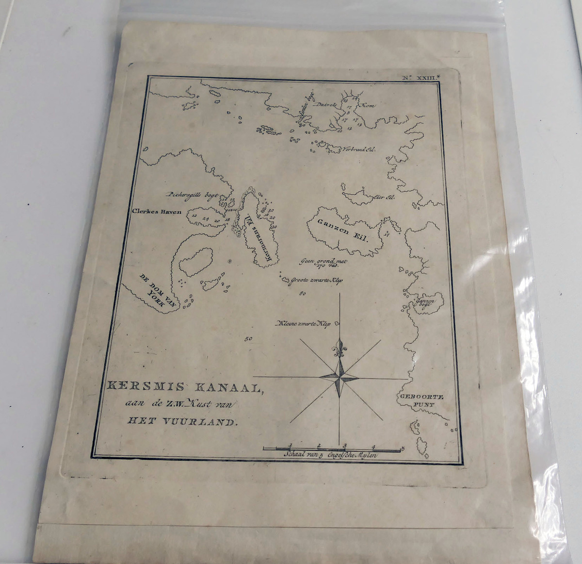
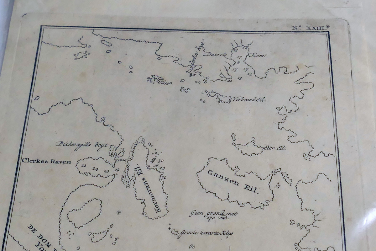
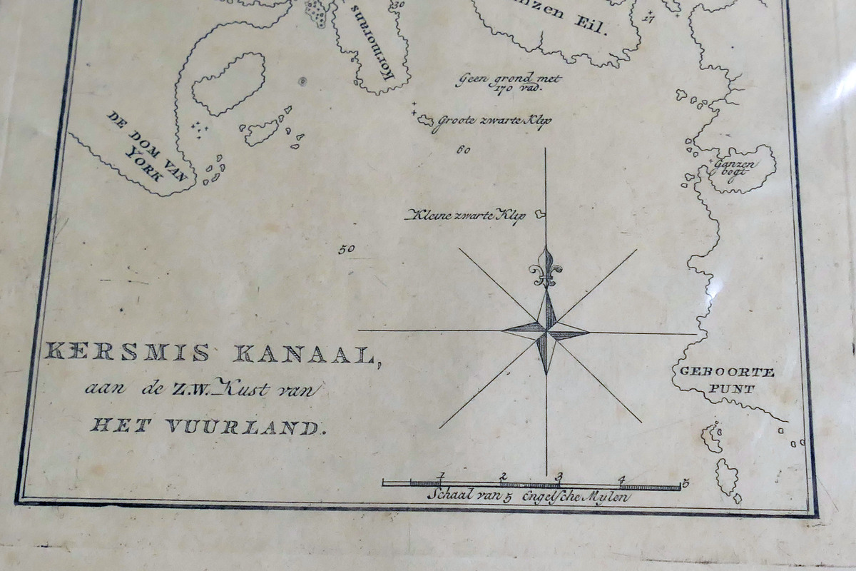
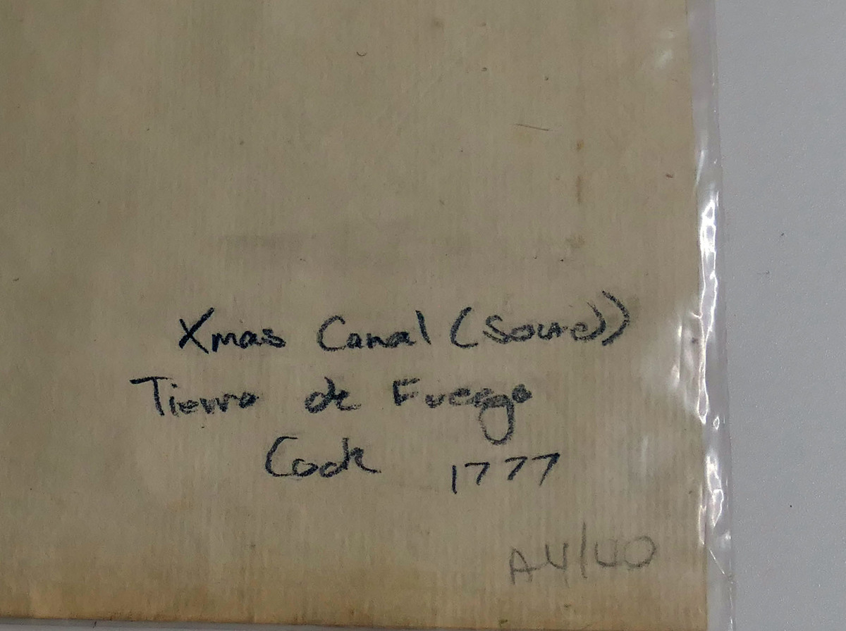
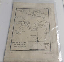
Original late?1700s Dutch nautical map from the Dutch edition of Captain Cook’s Second Voyage. Titled “Kersmis Kanaal, aan de Z.W. Kust van het Vuurland” (Christmas Channel, Southwest Coast of Tierra del Fuego), Plate XXIII.
Shows detailed coastline, anchorages, compass rose, and early Dutch cartographic engraving of the far southern tip of South America. Photographed through a protective sleeve — the map itself is clean and well?preserved.
Perfect for framing or for collectors of antique maps, maritime history, or Cook?voyage material.
Features:
Original 18th?century copperplate engraving
Dutch edition of Cook’s Voyages
Plate XXIII
Strong decorative appeal
Will be shipped rolled in a tube, map size 23cm x 20cm.
|
Why are we showing these items?
Search Results
Map, maps, atlases & globes"map" Category "Maps, Atlases & Globes"
|


 - $4.90")


-
Refine your browsing experience
We can show you more items that are exactly like the original item, or we can show you items that are similar in spirit. By default we show you a mix.
This item has been added to your cart
 18th Century Dutch Map – Kersmis Kanaal, Tierra del Fuego – Cook’s Second Voyage added to cart.
Only one available in stock
18th Century Dutch Map – Kersmis Kanaal, Tierra del Fuego – Cook’s Second Voyage added to cart.
Only one available in stock
View Cart or continue shopping.
 Please wait while we finish adding this item to your cart.
Get an item reminder
We'll email you a link to your item now and follow up with a single reminder (if you'd like one). That's it! No spam, no hassle.
Already have an account?
Log in and add this item to your wish list.