Antique Orig. 18th Century (1785) “An and 48 similar items
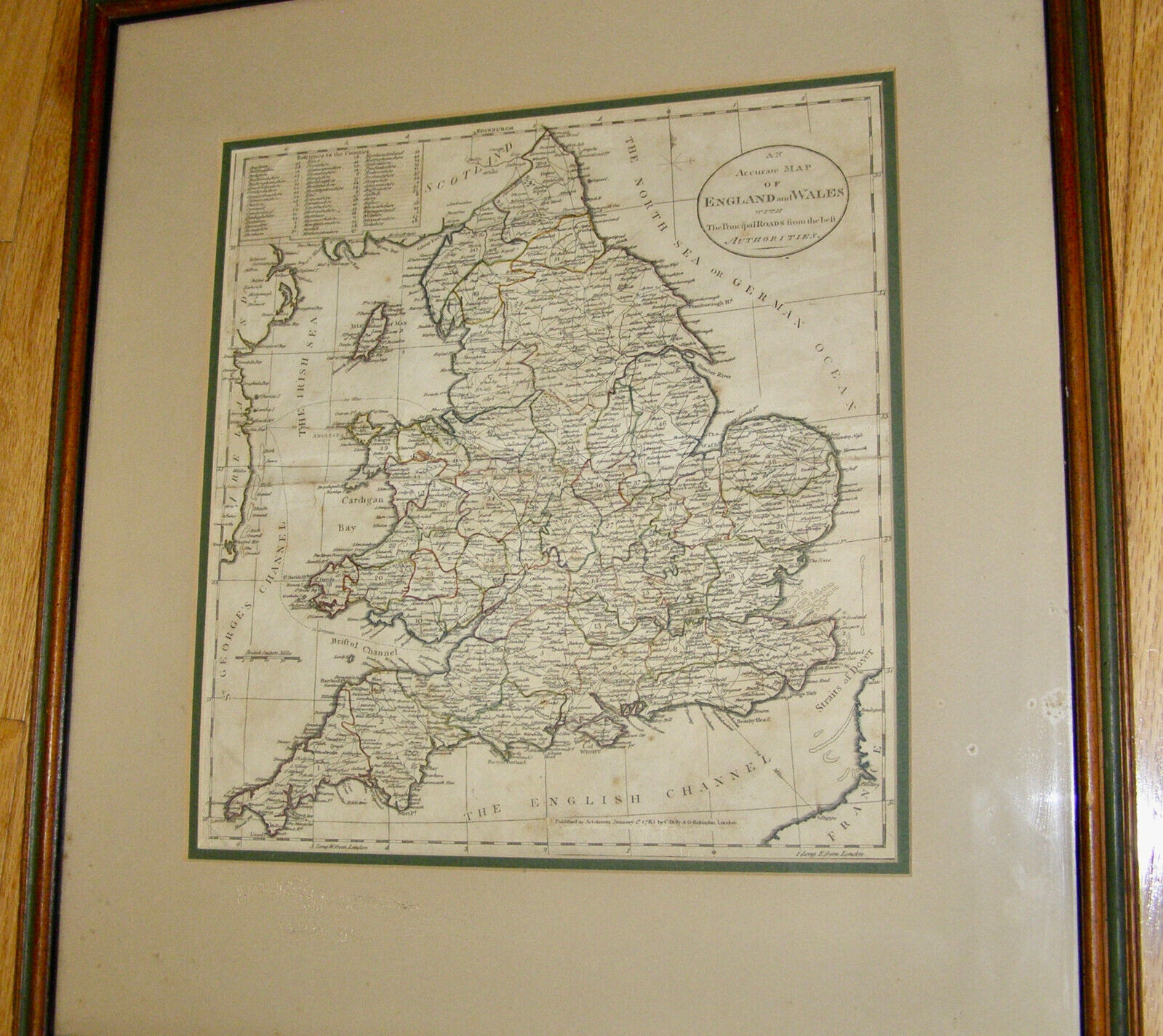
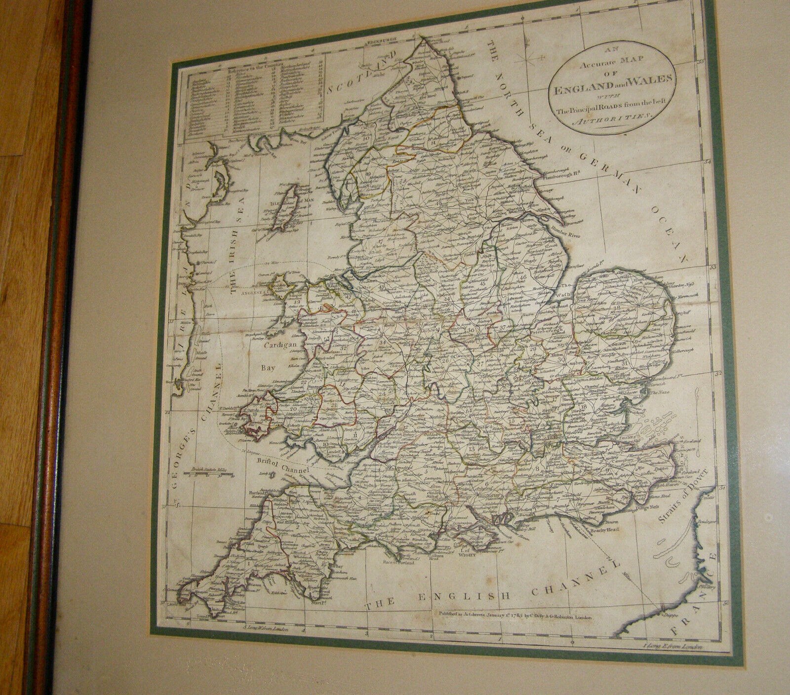
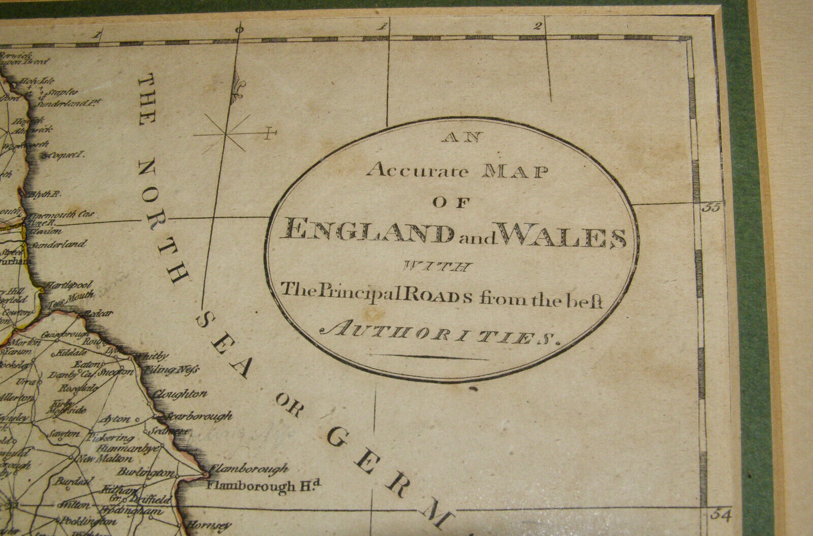
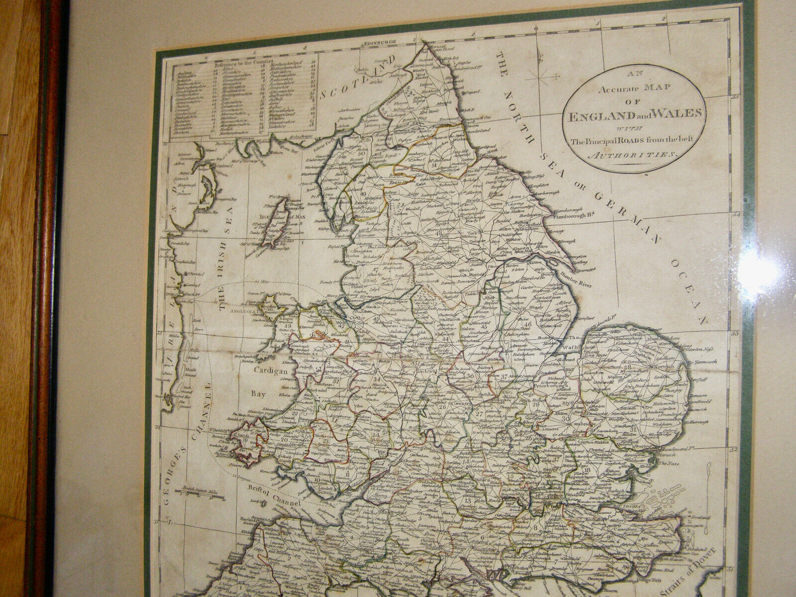
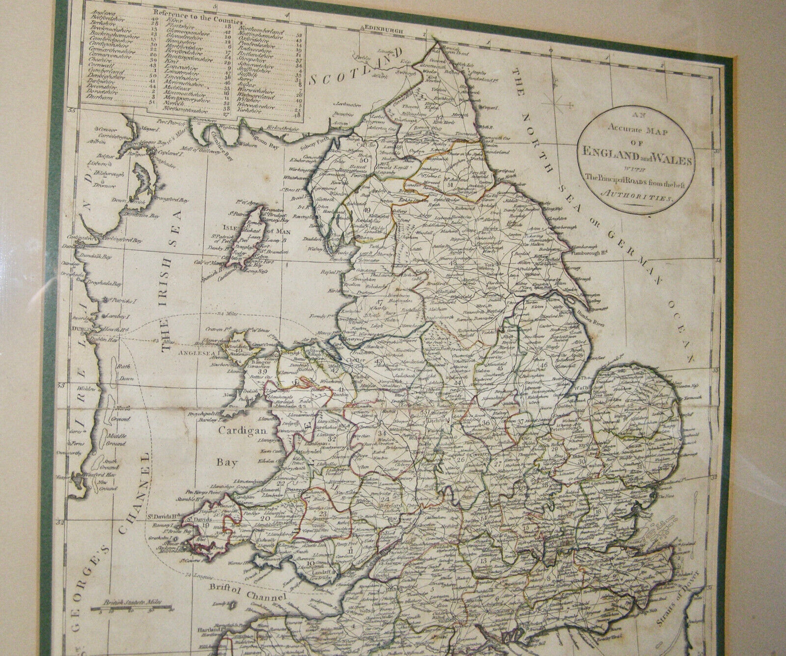
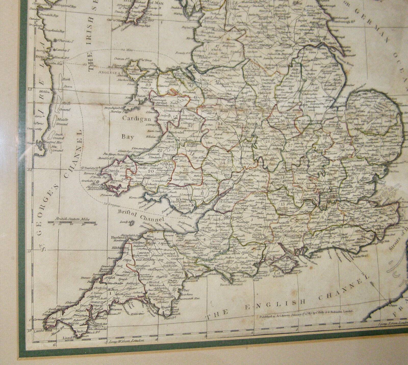
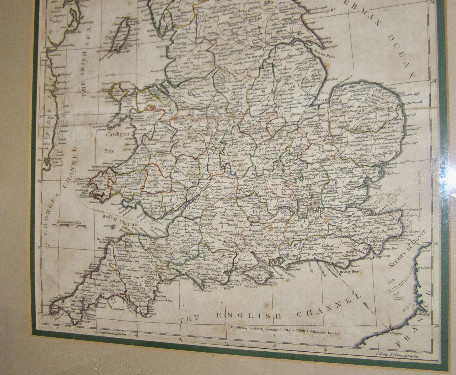
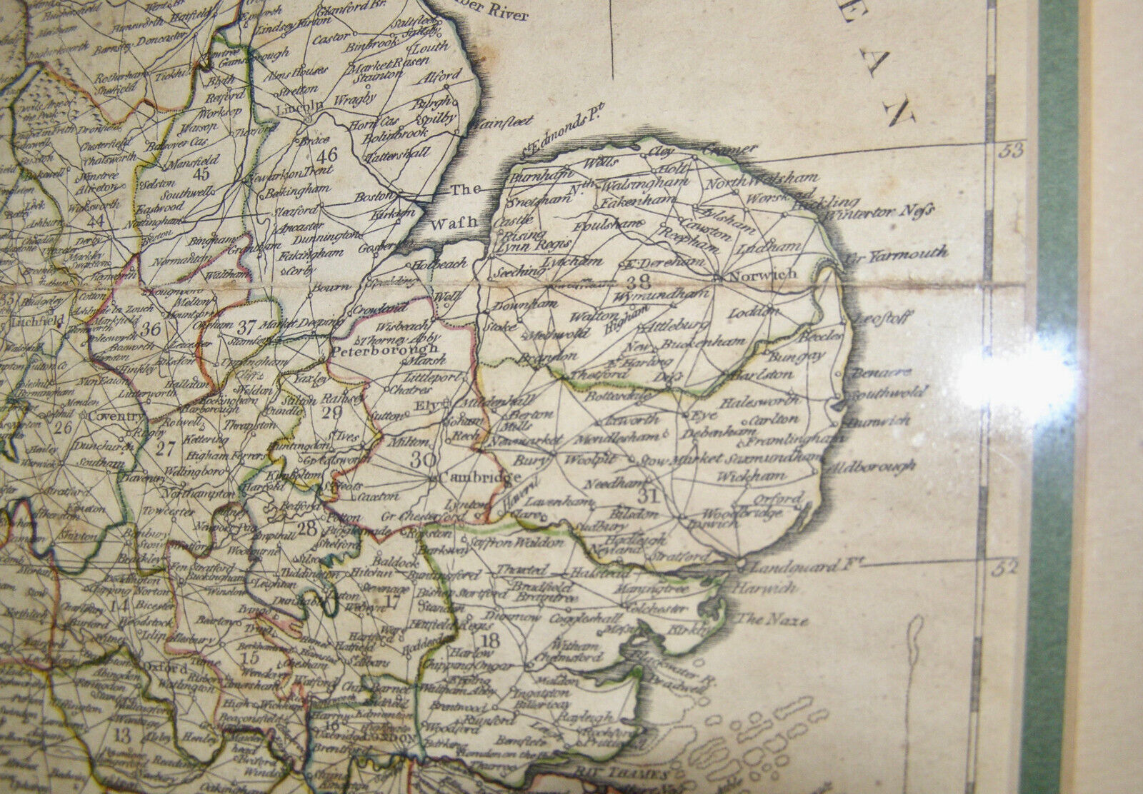
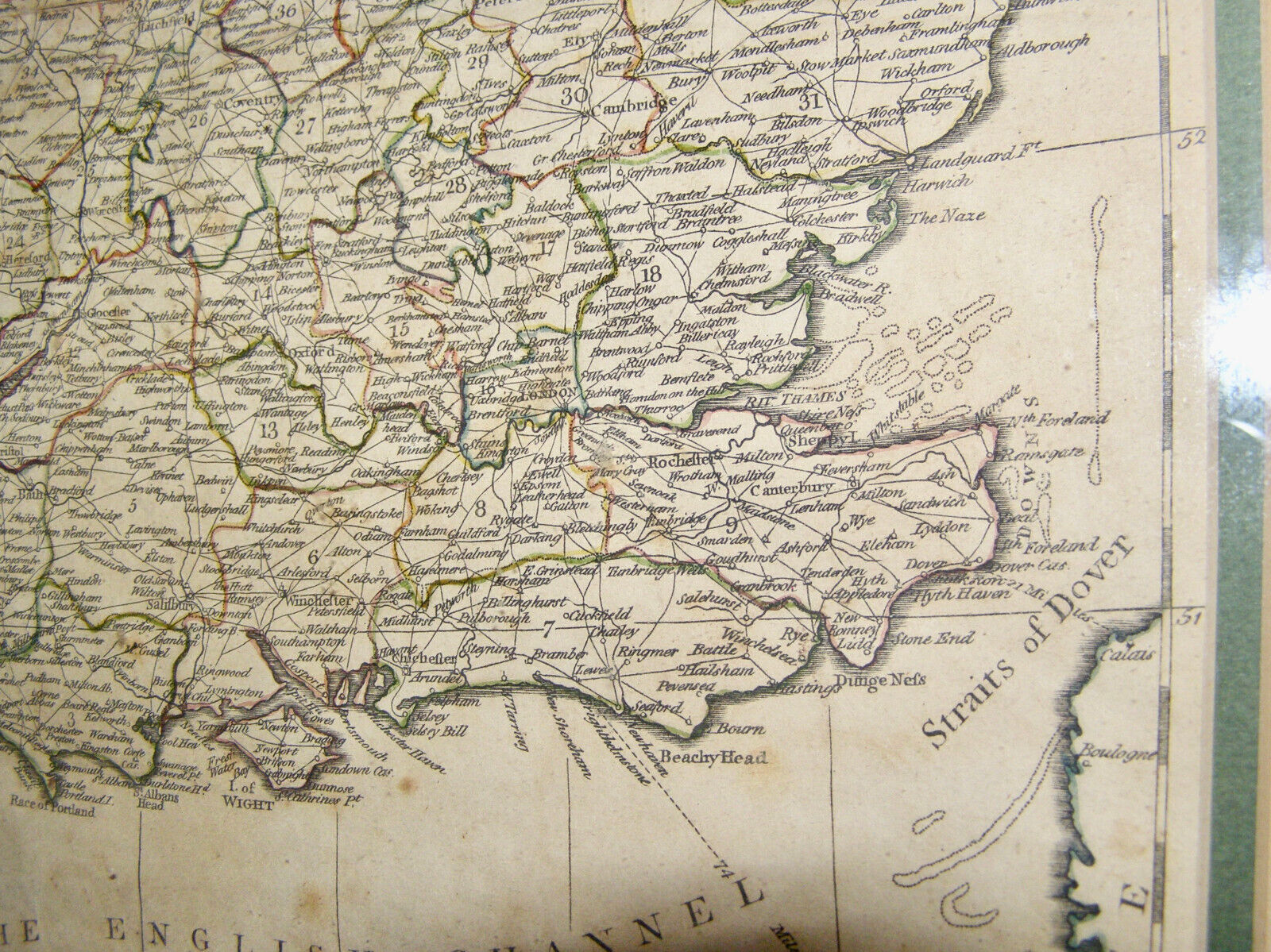
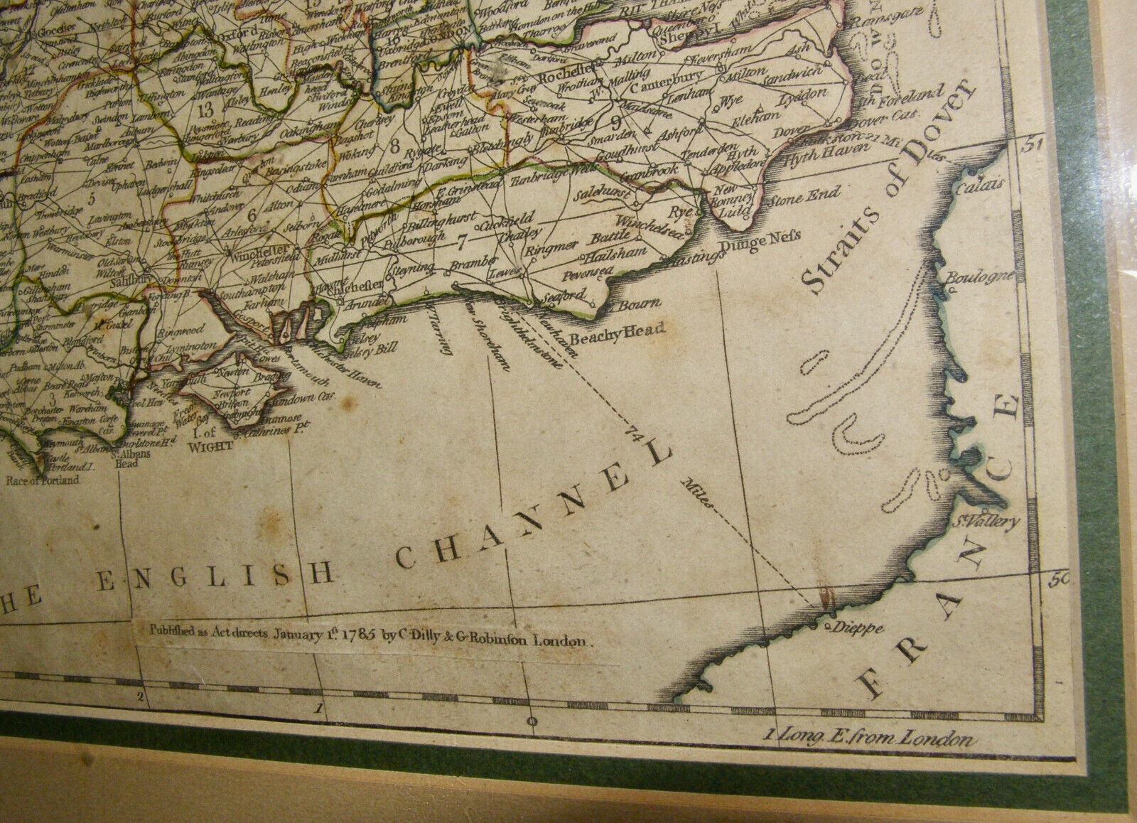
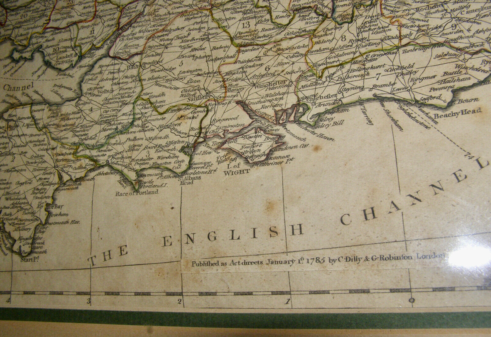
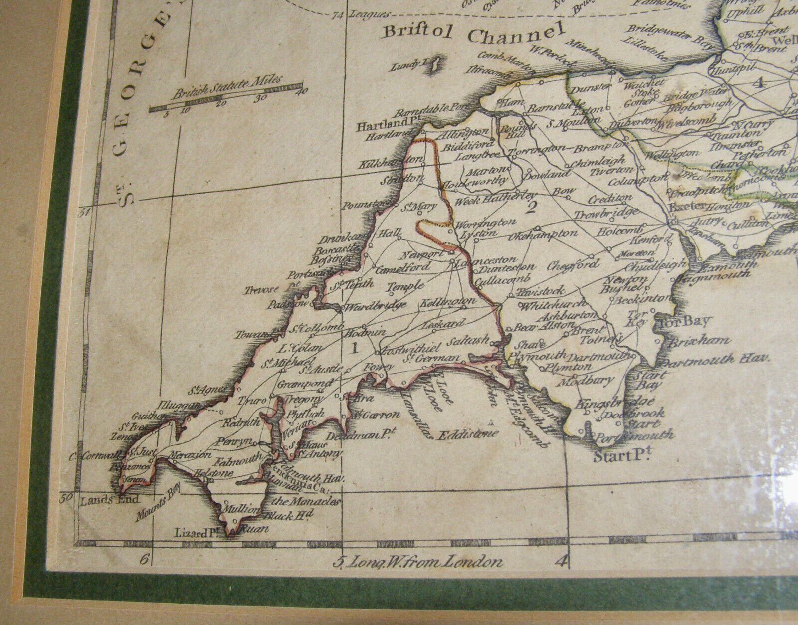
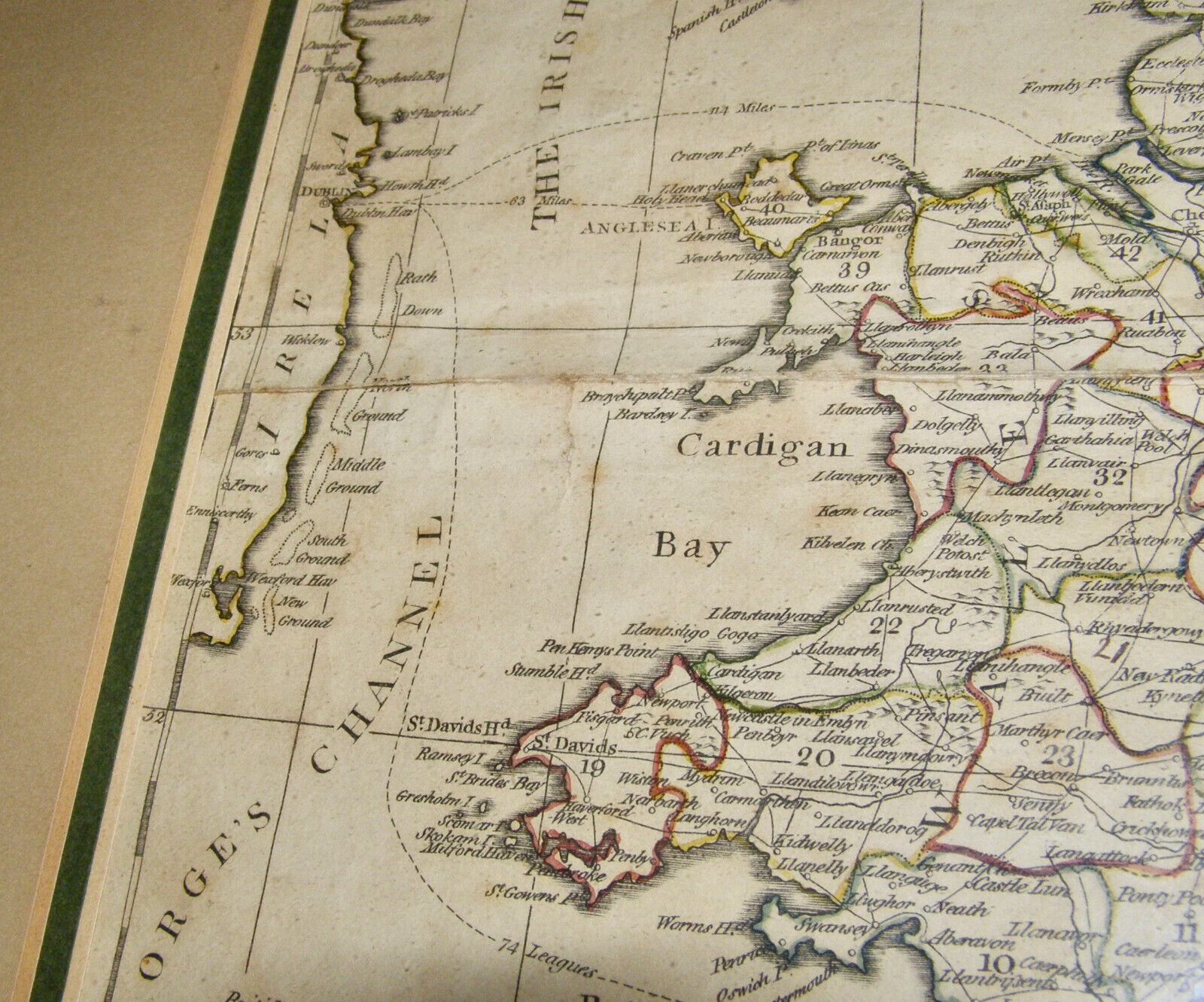
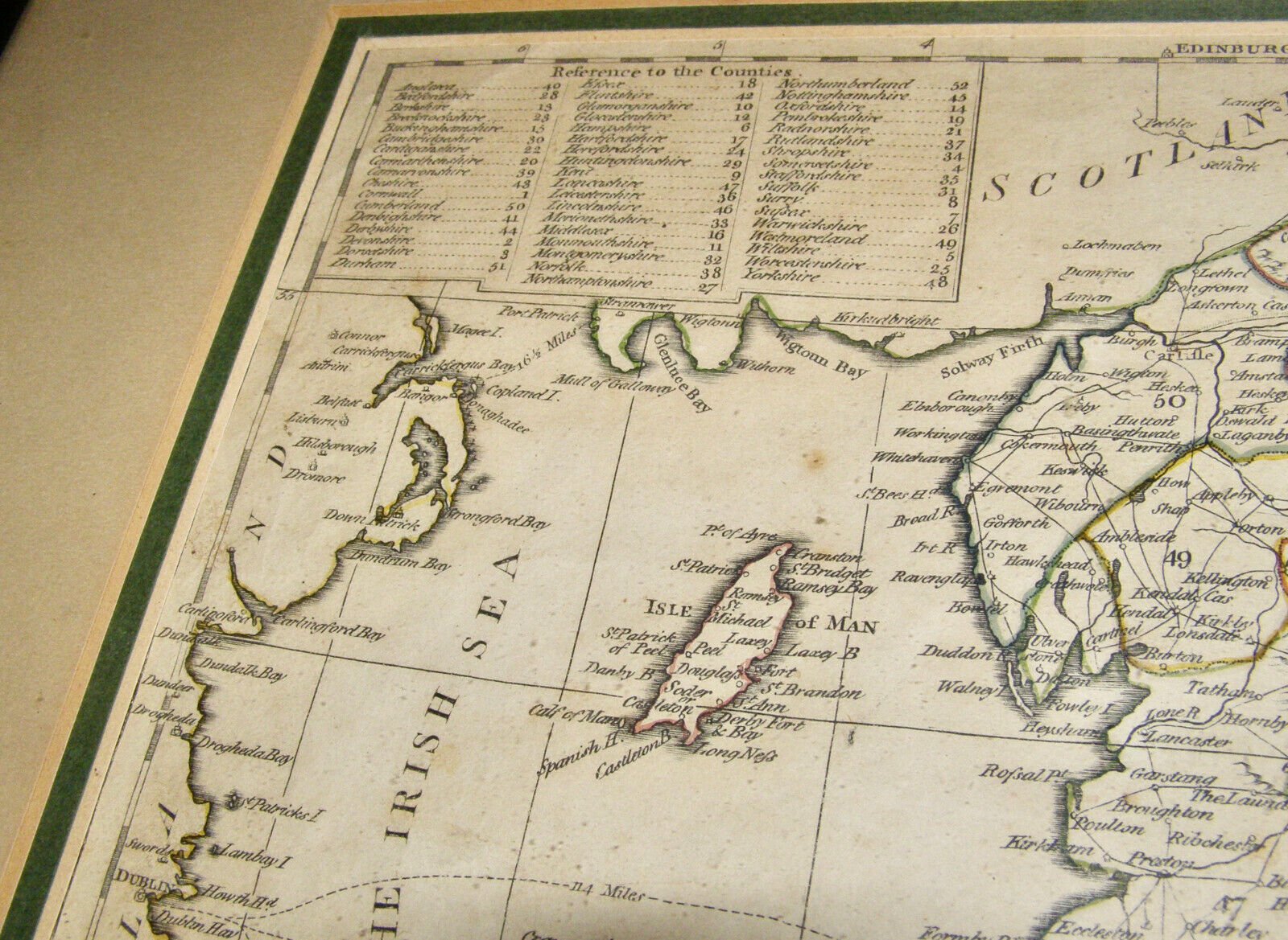
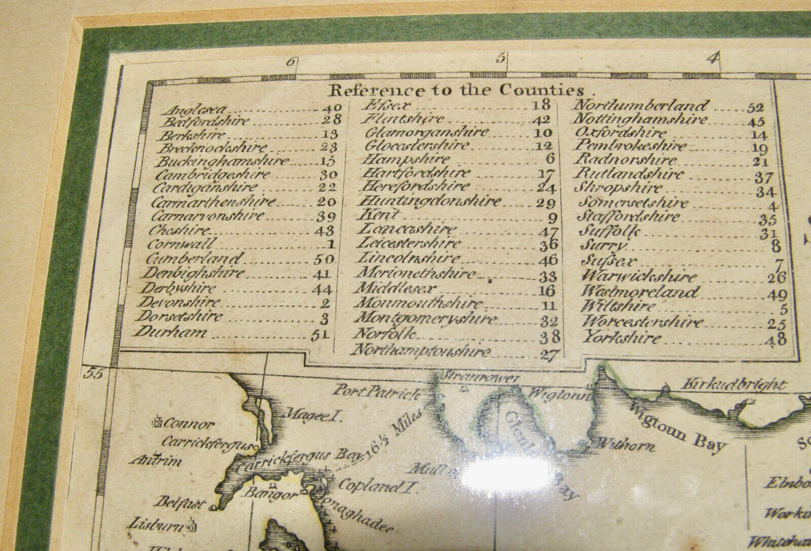
ANTIQUE ORIG. 18th CENTURY (1785) “AN ACCURATE MAP OF ENGLAND and WALES"-GUTHRIE
Sign up and get $5.00 bCredits free to use at checkout and another $5.00 bCredits when you make your first purchase. More info

Shipping options
Offer policy
Return policy
Purchase protection
Payment options
Shipping options
Offer policy
Return policy
Purchase protection
Payment options
Item traits
| Category: | |
|---|---|
| Quantity Available: |
Only one in stock, order soon |
| Condition: |
Unspecified by seller, may be new. |
| Original/Reproduction: |
Antique Original |
| Year: |
1785 |
| Country/Region: |
England |
| Format: |
Atlas Map |
| Date Range: |
1785 |
| Type: |
PRINCIPLE ROADS from the BEST AUTHORITIES - GUTHRIE’S SYSTEM |
| Printing Technique: |
HAND COLORED MAP, COPPER PLATE |
| State: |
ENGLAND AND WALES |
| Cartographer/Publisher: |
June 15th 1785 by C. Dilly & G. Robinson, 1785 |
| City: |
PRINCIPLE ROADS from the BEST AUTHORITIES - GUTHRIE’S GEOGRAPHY |
| County: |
ENGLAND ans WALES |
Listing details
| Shipping discount: |
No combined shipping offered |
|---|---|
| Posted for sale: |
More than a week ago |
| Item number: |
1731425721 |
Item description
|
Why are we showing these items?
Search Results
Map, maps, atlases & globes"map" Category "Maps, Atlases & Globes"
|


 - $4.90")


-
Refine your browsing experience
We can show you more items that are exactly like the original item, or we can show you items that are similar in spirit. By default we show you a mix.


This item has been added to your cart
 ANTIQUE ORIG. 18th CENTURY (1785) “AN ACCURATE MAP OF ENGLAND and WALES"-GUTHRIE added to cart.
Only one available in stock
ANTIQUE ORIG. 18th CENTURY (1785) “AN ACCURATE MAP OF ENGLAND and WALES"-GUTHRIE added to cart.
Only one available in stock
View Cart or continue shopping.
 Please wait while we finish adding this item to your cart.
Get an item reminder
We'll email you a link to your item now and follow up with a single reminder (if you'd like one). That's it! No spam, no hassle.