Chicago, IL Metro Wall Map and similar items
Free Shipping
Chicago, IL Metro Wall Map
$298.98
(Buy a Up to 30% discount card for $30.00 first, and you will save $38.87 on this item and get up to 30% off future purchases for the next 3 months.
Unlock the discount with just a few clicks - start here)
Share & earn! Sign in, share this or any listing, and you’ll get commission when it sells.
Learn more
View full item details »

Shipping options
Estimated to arrive by Wed, Apr 22nd.
Details
FREE via UPS Ground (1 to 5 business days) to United States
Return policy
Replacement product available within 30 days
Details
Purchase protection
Payment options
PayPal accepted
PayPal Credit accepted
Venmo accepted
PayPal, MasterCard, Visa, Discover, and American Express accepted
Maestro accepted
Amazon Pay accepted
Nuvei accepted
View full item details »
Shipping options
Estimated to arrive by Wed, Apr 22nd.
Details
FREE via UPS Ground (1 to 5 business days) to United States
Return policy
Replacement product available within 30 days
Details
Purchase protection
Payment options
PayPal accepted
PayPal Credit accepted
Venmo accepted
PayPal, MasterCard, Visa, Discover, and American Express accepted
Maestro accepted
Amazon Pay accepted
Nuvei accepted
Item traits
| Category: | |
|---|---|
| Quantity Available: |
Only one in stock, order soon |
| Condition: |
New |
| Country/Region of Manufacture: |
United States |
Listing details
| Seller policies: | |
|---|---|
| Posted for sale: |
More than a week ago |
| Item number: |
1441049845 |
Item description
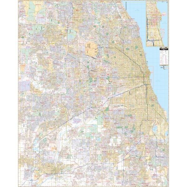
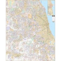
Chicago, IL Metro Wall Map Width 65, Height 80
Our Chicago, IL Metro Wall Map, with adjacent areas, measures 65? x 80? (5?5? W x 6?8? H) and features up-to-date cartography, with new streets and changes in complete street detail; is printed in color, with a markable and washable laminated surface; and offers a street index in a separate book-format.
Features Specs
The area of coverage includes all of Cook and DuPage Counties, and a portion of Will County, with the following boundaries:
? North to Barrington Hills, Wheeling, and Glencoe to Lake Cook Road
? South to the Cook County line and Chicagoland Speedway, in Will County
? East to Calumet City, Lynwood, and Lake Michigan
? West to the Cook, DuPage, and Will County lines
The Chicago, IL Metro Wall Map also includes an inset map of Downtown Chicago.
Details and features include:
? AIRPORTS
? BLOCK NUMBERS
? CEMETERIES
? CITY LIMITS
? EDUCATIONAL INSTITUTIONS
? FIRE POLICE STATIONS
? GOLF COUNTRY CLUBS
? GOVERNMENT BUILDINGS
? HOSPITALS
? LIBRARIES
? POINTS OF INTEREST
? POST OFFICES
? RAILROADS
? RECREATIONAL PARKS
? SECTION, TOWNSHIP RANGE LINES
? SHOPPING CENTERS
? STREETS HIGHWAYS
? WATER FEATURES
? ZIP CODE BOUNDARIES
Framing rails are included, top and bottom, for easy wall mounting.
Loading
This item has been added to your cart
 Chicago, IL Metro Wall Map added to cart.
Only one available in stock
Chicago, IL Metro Wall Map added to cart.
Only one available in stock
View Cart or continue shopping.
 Please wait while we finish adding this item to your cart.
Get an item reminder
We'll email you a link to your item now and follow up with a single reminder (if you'd like one). That's it! No spam, no hassle.
Already have an account?
Log in and add this item to your wish list.